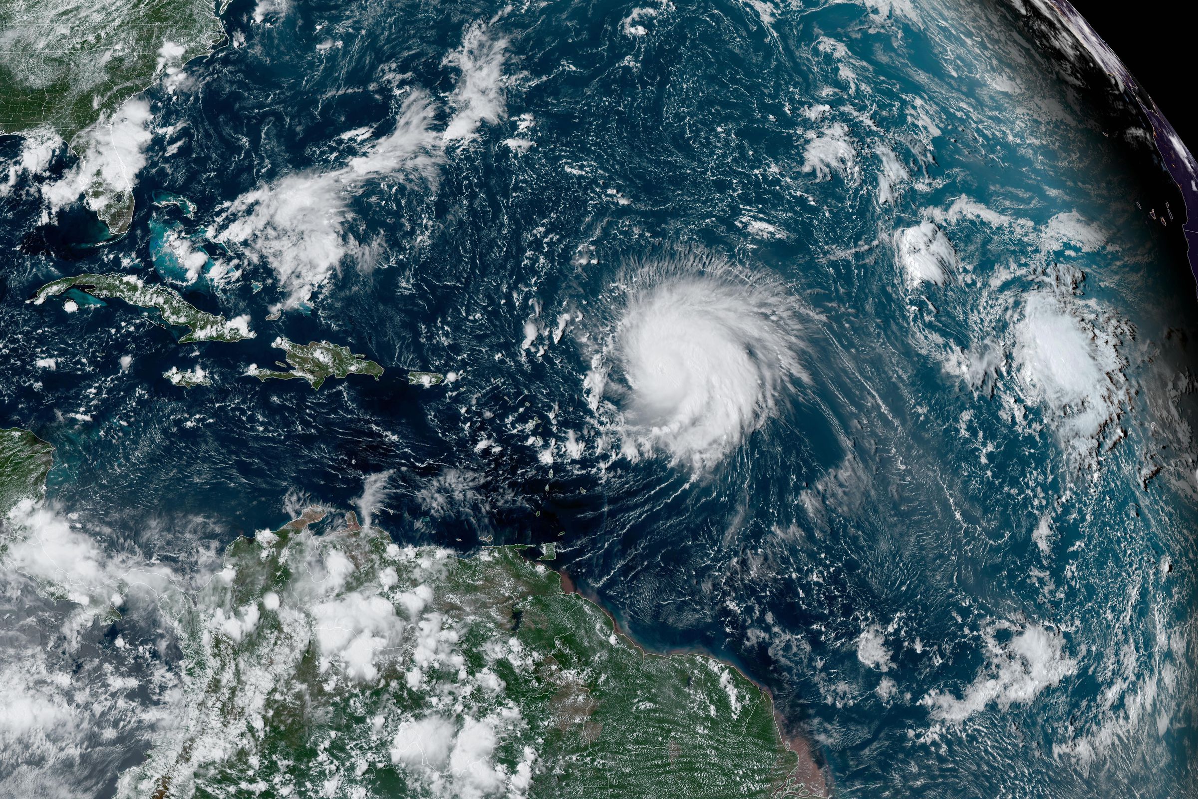
The Atlantic Hurricane season starts on June 1st, and it’s forecast to be rough. A record number of strong storms could form with a shift from El Niño to La Niña this summer and unusually warm waters churning in the Atlantic Ocean.
There’s an 85 percent chance of an “above normal” season, according to the National Oceanic and Atmospheric Administration (NOAA). It forecasts between 17 to 25 storms strong enough to earn a name (reaching wind speeds of at least 39 miles per hour). It also predicts eight to 13 hurricanes and four to seven major hurricanes.
Those are big numbers — the most named storms, hurricanes, and major hurricanes NOAA has ever predicted in its May outlook. For comparison, there was an average of 14.4 named storms, 7.2 hurricanes, and 3.2 major hurricanes per season between 1991 and 2020.
“This season is looking to be an extraordinary one in a number of ways,” NOAA administrator Rick Spinrad said in a press briefing. “The key this year as in any year is to get prepared and stay prepared.”
An El Niño climate pattern is currently in play, which can usually tamp down the Atlantic hurricane season because it usually means increased vertical wind shear that can tear a storm apart as it tries to gain strength. But the current El Niño is weakening and is expected to come to a close in the next couple months.
There’s now a 77 percent chance of a La Niña pattern forming sometime between August and October. La Niña tends to have the opposite effect on the Atlantic hurricane season, reducing vertical wind shear and allowing storms to strengthen uninterrupted.
Rising temperatures with climate change are another risk factor. Hurricanes have grown more intense with global warming since storms draw strength from heat energy at the sea surface. Record high water temperatures have already been recorded across the tropical Atlantic recently, and that heat is expected to persist into the peak months of the Atlantic hurricane season between August and October.
Those high temperatures also allow storms to intensify rapidly, which gives communities less time to prepare for their impact. All of the strongest storms, Category 5 hurricanes, to make landfall in the US over the past 100 years in the US were much weaker tropical storms or less just three days prior, with an average lead time of just 50 hours.
“Big ones are fast,” Ken Graham, director of NOAA’s National Weather Service, said on the press call. “That’s why I’m saying this time they don’t care about our timelines. Preparedness is absolutely everything.”
Other forecasters have made similarly worrisome predictions for the upcoming Atlantic hurricane season. Penn State scientists forecast a record-breaking 33 named storms for the Atlantic. Colorado State University’s Tropical Weather and Climate Research group anticipates an “extremely active” season with 23 named storms, 11 hurricanes, and five major hurricanes.
NOAA also estimates the Accumulated Cyclone Energy (ACE) for the season, a measure of overall storm activity. This year, it’s forecasting the second-highest ACE score it’s ever announced during its May outlook.
“In past years, when we’ve seen high ACE numbers, those have historically been the years with the most destructive hurricanes,” Spinrad said.